Saturday, October 24, 2009
Torlente Restaurant
This Italian restaurant located in Soi Lang Suan offers almost the same menu as “Pan Pan” restaurant. Since Pan Pan at the beginning of the road has been closed down, the staff and chef opened this place. My all-time favorite dish - Tuna Salad and Bacon Spaghetti are still superb. But this time the Mussels in chili tomato sauce dish is overcooked.
Friday, October 23, 2009
Sun Moon Restaurant
Wednesday, October 07, 2009
Karakorum Hiway - Day 14
Very quiet and serene surrounding
The early rise has paid indeed to be able to see this beautiful lake. It is very cold up there so I take some photos and decide to go back to warm my hands and feet at small fire inside the shacked tea house.
Lake Saiful Muluk has a touch of the unreal about it, nestling 3,200 metres high in the shadow of the Malika Parbat (Queen of the mountains) 5,291 metres high. You can go boating on the lake and hear the local legend about Prince Saiful Muluk who fell in love with a fairy. Further up are quaint woodland villages; Battakundi, Burawai, Besal Gittidas and Lalazar.
Passing glacier on the way to the lake. And I think that when the winter comes, it probably covers the road. I am not sure that in winter the lake would be accessible by car or not.
Another day on the road is waiting for us on our last day in Pakistan. We decide to go back to ISB by road instead of taking a flight from Gilgit or Skardu because of the uncertain weather. Sometimes there is no flight for 3 consecutive days if the weather is not good.
And that would be all for my wonderful trip.
Thanks Nong Nat, Nong Nath and Dr. Chic for let me join this trip and have a good time together. Take good care of each other.
Also thanks to Altaf who takes good care of us all. He is more than just a guide to us. He has become our friend.
And we all hope to visit Pakistan again.
If you would like to visit Pakistan one day, I would highly recommend him.
Managing Director
Roughly the map of our trip. (there are some minor changes from the plan) Thanks Nong Nat for the picture.
Tuesday, October 06, 2009
Karakorum Hiway - Day 13
Waiting for the tire fixing, Nong Nat is surrounded by the local villagers. The children is on their way to home. Normally we are the one who take the local photos but now it's time that we have to pay back because one guy is having a mobile phone with the camera. So he takes our photo and also asks to take photo with Nat too. :-)
Our first stop for today is at the rock carving at Chilas before driving through the Babusar Pass (4,200 meters). It takes about 3 hrs for 43 kilometers. Not another clear day but windy and cold.
On the Barbusar Pass, red mountain with the snow.
At the top, the view has me speechless - around with mountains. But I only take a few pictures since it is so cold and windy. And finally we see a lot of snow falling on the way down.
Our car has to cross that small wooden bridge!! My goodness!!
Babusar Pass or Babusar Top (el. 4173 m./13,691 ft.) is a mountain pass at the north of the 150 km. (93 miles) long Kaghan Valley connecting it via the Thak Nala with the Indus Valley. It is the highest point in Kaghan Valley.
The Kaghan Valley is at its best during summer (months ranging from May to September). In May the maximum temperature is 11 C (52 F) and the minimum temperature is 3 C (37 F). From the middle of July up to the end of September the road beyond Naran is open right up to Babusar Pass. However, movement is restricted during the monsoon and winter seasons. The Kaghan area can reached by road via the towns of Balakot, Abbottabad and Mansehra.
Stay overnight at Naran.
Monday, October 05, 2009
Karakorum Hiway - Day 12
View from our hotel room.
At Satpara Lake. At present, the power stations and a dam are under construction. It probably will raise the level of the lake, so the foreshore and the picturesque island might be submerged.
The next lake that we visit is Katchura Lake near the Shangri-la Hotel. The view is spectacular!!!
This last picture, I copies the perspective from Nong Nat's photo. Thanks a lot for sharing the view with me. I really like this one.
Sunday, October 04, 2009
Karakorum Hiway - Day 11
Finally we leave the place without seeing the Glacier since the sky is so cloudy and doesn't look like the sun will shine soon.
Passing through another village. Altaf is invited by his friend to have some tea. In Pakistan, tea is what one usually offers to visiting friends. His friend also extend his hospitality to our gang.
Waiting for Altaf to take care of the 5 holes on a tire, we are trying to take some children photos. Look at their first reaction when we first start taking their photos.
But after getting used to our frenzy photo taking, viewing their own pictures and sharing our sweet toffee, they began to play with us and enjoy being taken photos.
We take children photos for a while before it seems that we are now the focus of many villagers. Some even come to ask where we come from.
Then, another long drive to Deosai National Park.
Shausar Lake
There is a lake named Shausar Lake in the Deosai Plains meaning in local language"white lake"-Shau-white,Sar-lake. The lake is at a height of 4,142 m (13,589 feet). Its approximate length is reported to be 2.3 km (1.4 miles), width 1.8 km (1.2 miles) and average depth 40 m.
Golden Marmot.
The weather is still very cold. We finally stop at Altaf’s friend tent to have simple late lunch (instant noodle).
Deosai National Park
The Deosai National Park is located in the Skardu, Northern Areas of Pakistan that is known as the Federally Administered Northern Areas (FANA). The park is located on the Deosai Plains, that are among the highest plateaus in the world with an average height of 4,114 metres above the sea level, covering an area of about 3,000 square kilometers. For just over half the year - between November and May - Deosai is snow-bound. In the summer months when the snow clears up, Deosai is accessible from Skardu in the north and the Astore Valley in the west. Deosai is well known for its spring season when it is covered by a carpet of millions of flowers and a wide variety of butterflies.
Deosai Plains make up one of the last frontiers of natural habitat for the Himalayan Brown Bear, a creature that once roamed the mountains freely. The Deosai National Park was established in 1993 to secure the survival of the bear and its habitat. Having long been a prize kill for poachers and hunters, the bear, Pakistan's largest omnivore, now has a hope for survival in Deosai where its number has increased from just 19 in 1993 to 40 in 2005.
We reach Skardu about 8:00 p.m to stay at Hotel Mashabrum.
Saturday, October 03, 2009
Karakoram Hiway - Day 10
In front of Raikot Sarai where we stayed overnight.
We confirm to walk down by ourselves instead of sitting on the horse. Rahim, Altaf’s assistant, helps both Nong Nat and me to carefully negate the slippery walk way.
Then we sit on the same jeep down to Raikot Bridge. This time Nong Nat and I sit in the front with the driver. However, I insist to sit in the middle. Thanks that the passenger side is on the inner side of the road. Anyway, I am still too scared to take any photos along the way.
From there we proceed to Astor town to visit Rama Lake. However the sky is not cleared, foggy and cloudy. But the view looks like the painting, unreal for me.
Friday, October 02, 2009
Karakoram Hiway - Day 9
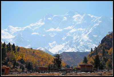
Nanga Parbat (8,125 m), is the highest Himalayan peak in Pakistan. All other peaks above 8,000m are in the Baltoro Muztagh subrange of Karakoram.
View in front of the Fairly Meadow Cottage
After breakfast, we walk to the viewpoint. It normally takes about 3 hours back-forth, but we top all the statistic record at 8 hours (including lunch and tea). The view is superb.
Beyal village
At the viewpoint.
Tonight we move to Raikot Sarai, another accommodation up there. For me I like Fairly Meadow cottage more than this one, but the view here is spectacular.
Thursday, October 01, 2009
Karakoram Hiway - Day 8
One of our favorite subjects to take photos: the decorated truck!
Most of local Pakistani that we meet in this trip are friendly.
Nanga Parbat
Today is the day that I was most worried before the trip since it required a lot of walking uphill. Anyway, I read a travelling article about this place and knew that I can get some help: horse. So I confirm Altaf that I will definitely need one to carry me up.
We change to the local jeep at Raikot Bridge. Due to the road condition, a local and expertise driver is required to drive up. We also rent one, Nong Nat and I sit on the back while Nong Nath and Dr. Chic sit in front. Pe Aoy, our friend visiting Pakistan 2 years ago, called this one as a “hand-made” road.
We stop to have lunch at Tato village and change the conveyance to horse. Nong Nath prefers to walk, he is very capable. We get to the top almost at the same time. The walking passage is very small, quite scary if we miss our foot.
The weather is so cold up there. Without the warm water, I decide to forego bathing. They also build the campfire for us too.
Stay overnight at the Fairly Meadow Cottage.